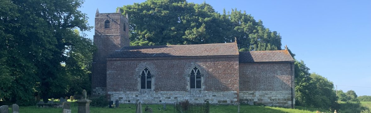
1792 seems to have been a year of significant change for the Welton le Marsh. A lot of land changed hands – in particular to the Reverend Edward Walls. The tithes were commuted for land and corn rents (which is probably why the map was drawn up) and the church was rebuilt with funds raised by public subscription.
The map made that year shows the significant changes which happened between 1791 and 1792. The map shows the names of fields, their owners and values in pounds, shillings and pennies.
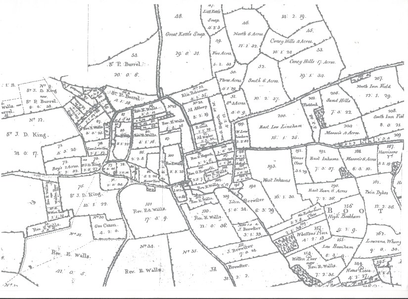
See a larger image at https://www.dropbox.com/s/0pimx4upw7mvzkd/1792%20map%20-%20centre.jpg?dl=0
Main Road
On the South side of main road between the Gunby Road and Rea Lane, there is a single building (in plot 100 a) which is now called “The Old Post Office”. Opposite all of the land to the South of the Beck is marked as “Manor Yard”, possibly suggesting that this was the manor house. Surprisingly, the size of the garden around the house is the same now as it was 230 years ago.
The Current “Rea House” can be seen with two other buildings on the same plot (102), possibly barns. There are two buildings on the opposite side of the Beck, which may have been a watermill (which was listed in the Domesday book).
On the North side of Main road, the Wheel Inn had yet to be built (on plot 81) but there are two buildings behind its future site, which lasted until the 1960s. On the opposite side of the driveway separating the current pub and blacksmith’s cottage are two further buildings on plot 80.
Curiously, the Church is not drawn on its plot (78), possibly as it was derelict when the map was produced. The adjoining plot (77) now occupied by Baytree cottage (and later divided West – East) has a very small plot (79) in the South East which is owned by the Lady of the Manor, it is not clear what this is for or whether it had a building on the site, but as it adjoined the Church yard it may have had a religious significance such as a tomb or chapel.
Fields North of the Beck
Currently when you take the path behind the church and cross the bridge over the beck, you come to a high earth bank along the edge of a single field, with a path that joins Beck Lane.
The map shows that this are used to be very different, divided into seventeen fields with a road across the middle. Just as the current path to beck lane turns its only corner, you can see the indentation in the earth bank when the old road used to join. The current path sued to be a more significant road.
Beck Lane
Plot 73 now houses the Wesleyan chapel (and in the 19th century a brick building covering the spring at the source of the Beck) and “South View” house. In 1792 there were two buildings, surprisingly neither near Beck Lane over the spring which gives the village it’s name.
At the North end of Beck Lane, a foot path is shown which is now the driveway to “Field House”. This is surrounded by the same small fields that remain there now, probably at least mediaeval in origin, possibly older. Since Neolithic times, fields were small, representing the area of land that a single person could farm throughout the year with just hand tools (as opposed to horse- or ox-drawn ploughs). https://en.wikipedia.org/wiki/Field_system
Whilst “Field House” was yet to be built, other buildings can be seen in this area, including two which face on to the large field (plot 8) which adjoins Welton Low Wood.
Where Beck Lane now becomes the driveway for Field House, it used to fork and a major road ran East-West, connecting Beck Lane to Hanby Lane. The join is now covered by the modern bungalow, “October House” and a line of trees covers the path of the road along the South side of the filed (plot 54 a). This road forked again and ran North-South between plot 54a and the small fields of Field House.
Sea Road to Habertoft and Orby
The road to Orby at the East edge of the village does not currently have an official name marked on maps. However, in 1792 it was marked as “Sea Road”.
The plot on the corner (28) had a mud-and-stud house that was demolished in the 1960s to make way for the current bungalow “Fair Acre”, however, this is not shown on the map. The construction of the house suggests it may have been built in the seventeenth century, but possibly it was after 1792, using cheaper (non-brick) techniques.
